
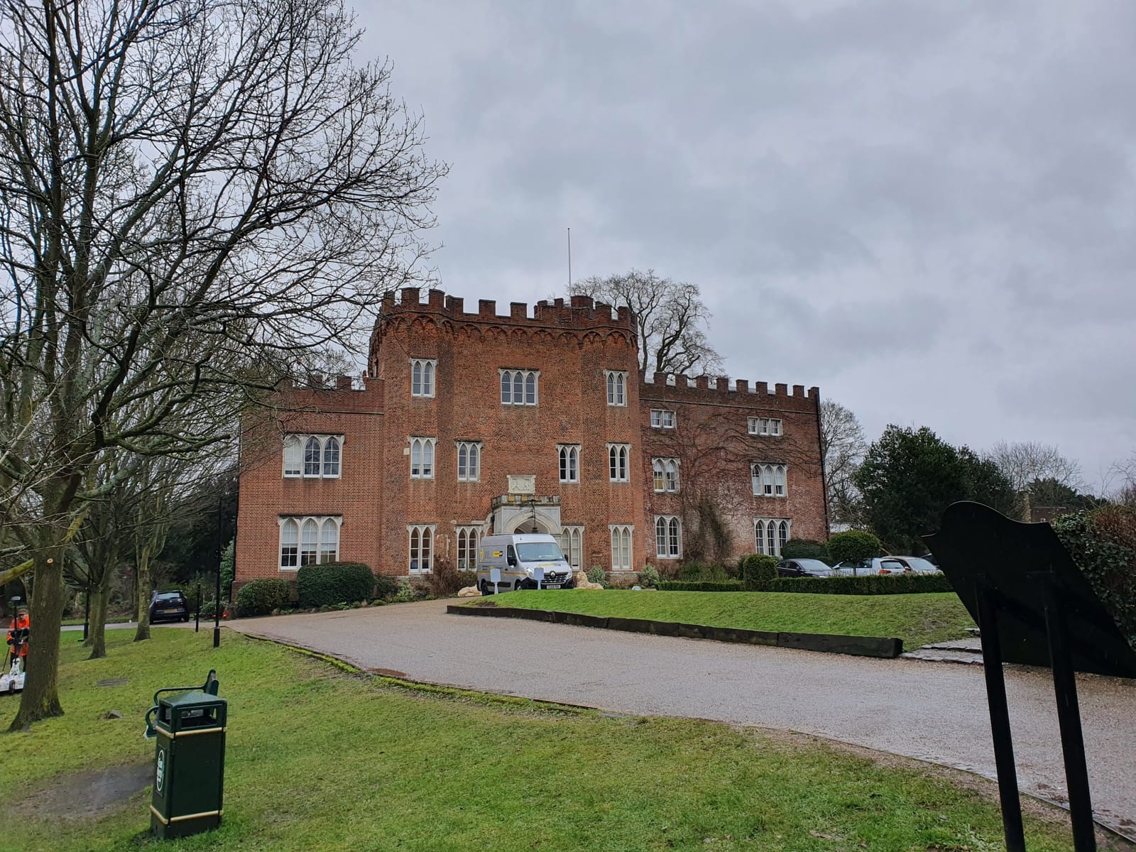
A comprehensive archaeological geophysical survey conducted at Hertford Castle in January 2025 has provided several new insights into the site's complex history. Hertford Castle Greenspace Renewal Project commissioned the study as part of enabling work to identify subsurface archaeological features before planned site improvements. Using high-resolution magnetic gradiometry and ground penetrating radar (GPR), TerraDat investigated approximately 1 hectare across three key areas: the western gardens, eastern gardens, and "the Island" area across the River Lea.
The investigation employed state-of-the-art geophysical techniques, including a Sensys Magneto MXV4 multi-sensor magnetic gradiometry system and an Impulse Radar RAPTOR 45x multi-channel GPR system. The magnetic survey used a specialist modular cart with five fluxgate gradiometer probes mounted at 0.25-metre sensor separation, providing high-resolution data. The GPR system operated with eight channels at 0.084-metre spacing, using a 450 MHz swept frequency to detect features up to 2.25 metres below ground level.
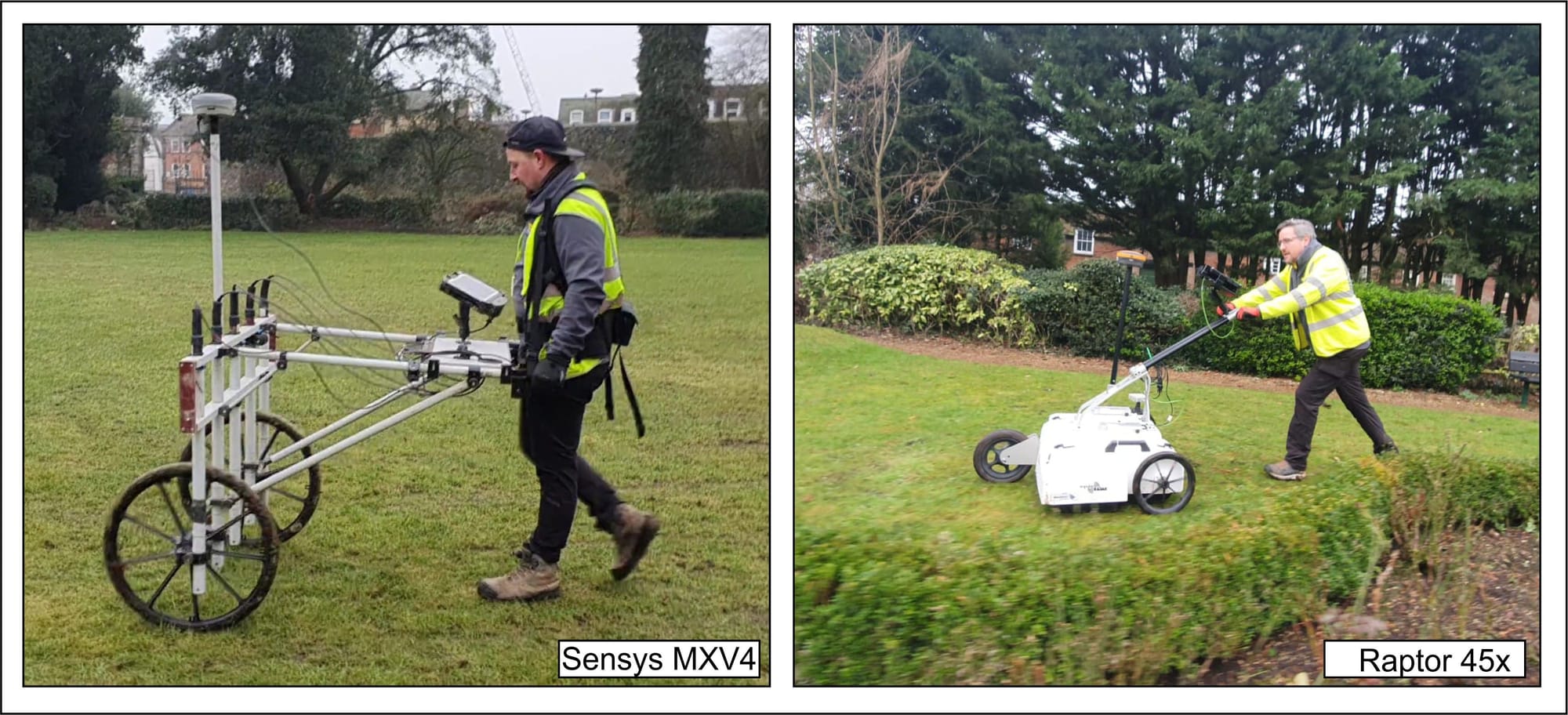
[Image: Survey equipment - showing both the magnetic cart and GPR system in operation]
Three distinct survey grids were established to cover the main areas where development work is planned, with the survey conducted under a Section 42 licence from Historic England.
The magnetic survey proved challenging due to extensive modern metallic interference from utilities, fencing, and modern structures typical of an urban castle site with continued occupation. The strong magnetic material at the site necessitated the display of magnetometer data using two different value ranges: ±50nT for visualising major ferrous anomalies and ±15nT for highlighting more subtle archaeological features. However, the GPR survey yielded exceptionally clear datasets with strong signal returns, providing high-resolution imaging of subsurface features throughout the investigation area.
Bridge and Causeway Discoveries
The most significant discoveries emerged from the western gardens area in front of the Tudor gatehouse, where GPR detected previously unknown medieval bridge arrangements buried beneath a later causeway. The survey revealed evidence of an 11-metre-wide moat with possible walled edges on both sides, containing several substantial structures measuring 0.6 to 0.7 metres in width.
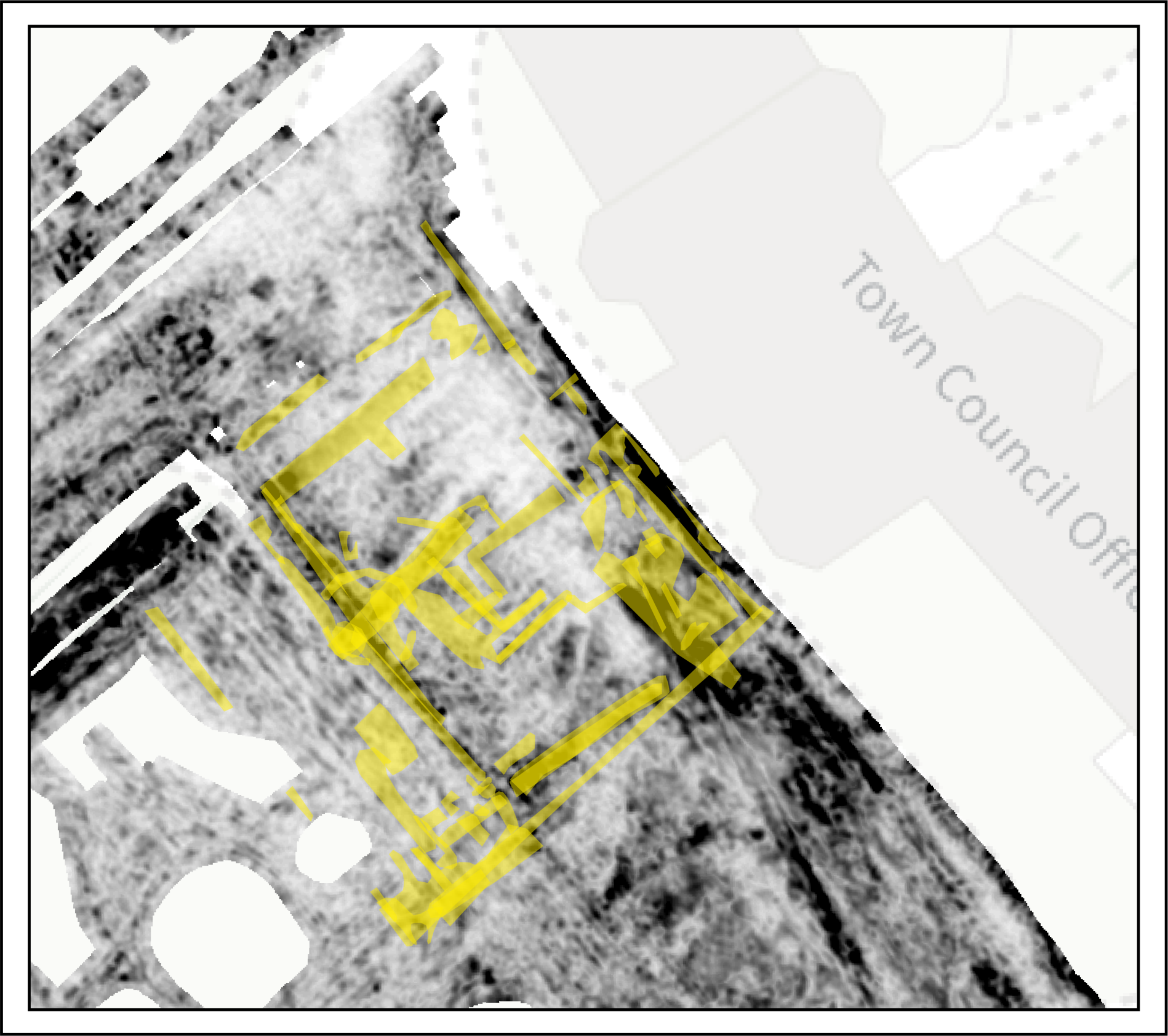
[Image: GPR depth slice showing the bridge structures within the causeway area]
Within the causeway area, the GPR identified a series of significant reflectors, including a distinctive 'T'-shaped configuration measuring 7.5 metres in length that extends from the outer edge of the moat toward a point between the gatehouse porch and its northwest corner. These structures are interpreted as remnants of medieval bridge arrangements deliberately buried when the causeway was constructed, marking a significant shift from defensive to ceremonial grandeur.
The survey also identified what appears to be a substantial ditch approximately 2.5 metres wide and 2.0 metres deep, oriented at a marked angle to both the river and castle defences. This feature may predate the castle entirely, suggesting earlier activity on the site.
Tudor Palace Complex Revealed
In the eastern gardens, now occupied by a formal lawn, the GPR survey has provided unprecedented detail of the Tudor royal palace buildings described in Henry Hawthorne's 1582/1592 plans. The survey revealed three ranges of buildings that once surrounded a large courtyard, running along the south, east, and north sides of the current lawn area, with the complex opening to the west toward the gatehouse.
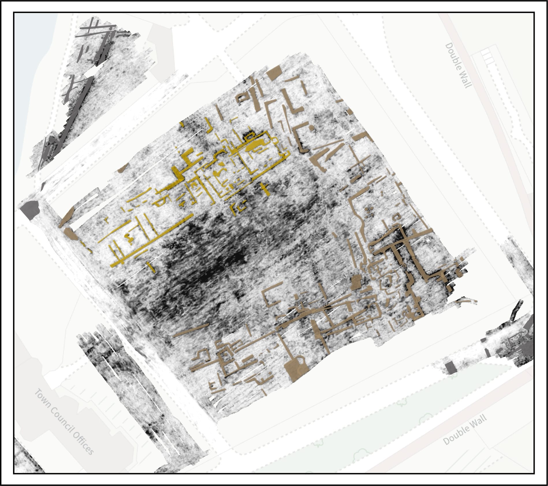
[Image: Combined GPR interpretation showing the three ranges of Tudor buildings]
The southern range shows a complex arrangement of divisions over approximately 40 metres, with structures reaching a maximum width of 15 metres. At the eastern end, a discrete rectangular structure measuring 13.7 by 5.2 metres was identified, featuring walls 0.6 metres thick and oriented 6 degrees clockwise compared to the main range. This structure overlaps with the main southern range and includes a particularly robust dividing wall 0.9 metres thick.
The eastern range is dominated by a large 'key-shaped' anomaly with walls 0.8 to 1.0 metres thick—significantly more substantial than most other walls in the complex. The anomalies associated with this feature extend from 0.45 metres below ground level down to 2 metres depth, suggesting a substantial basement or cellar structure.
The northern range, visible over 42 metres in length and approximately 40 metres wide, appears divided into five or six discrete units. The range incorporates several highly reflective external masses measuring 2.0 by 1.7 metres that appear likely to be the bases of chimneys, possibly representing secondary additions to earlier structures.
Challenging Historical Interpretations
One of the survey's most significant contributions is demonstrating that Hawthorne's plans, while accurate in their representation of internal room divisions, significantly simplified the actual orientation of the building ranges. Previous reconstructions assumed the structures were entirely orthogonal, but geophysical evidence indicates that the northern and southern ranges actually converge slightly to the west rather than running perfectly parallel.
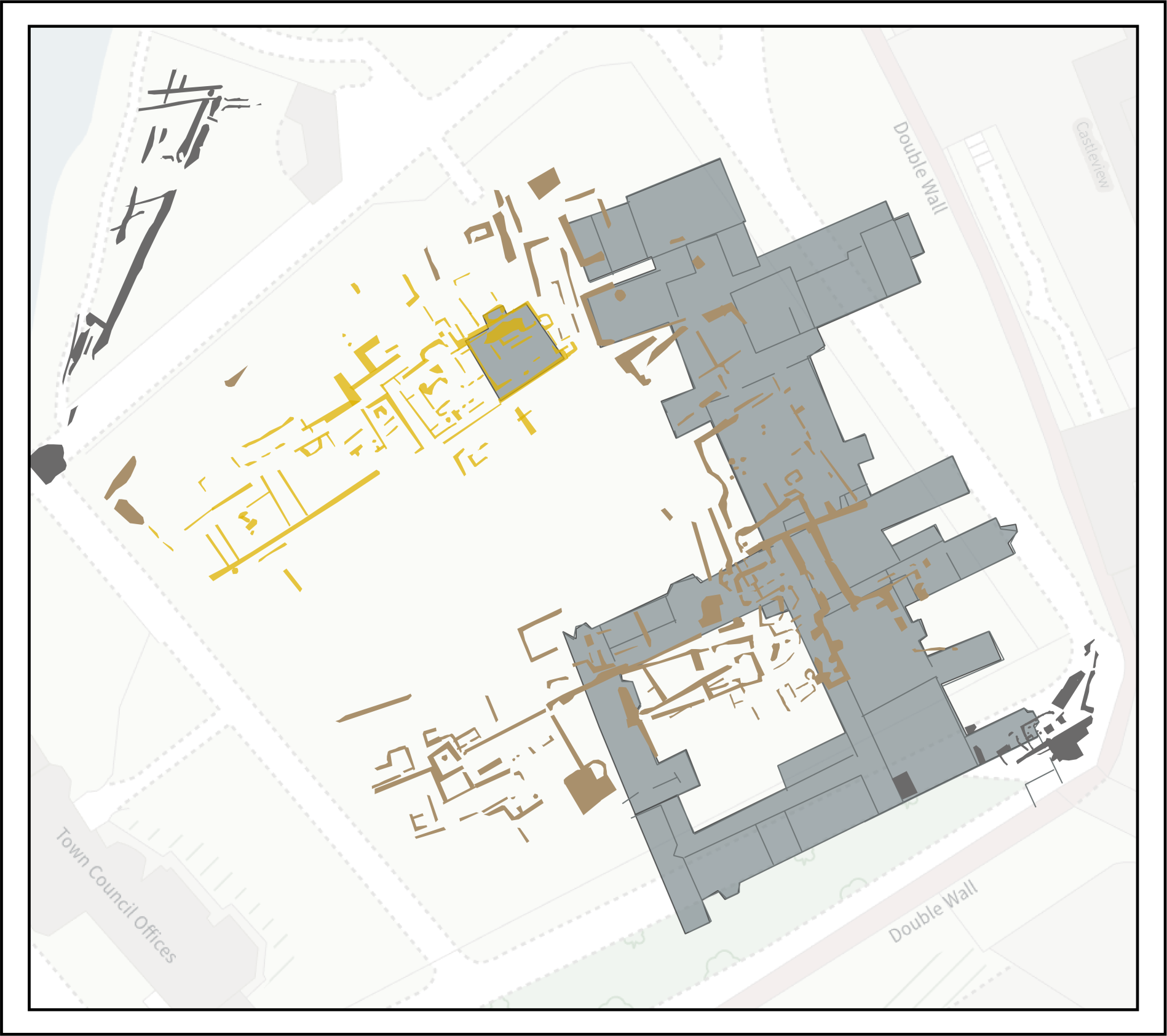
[Image: Comparison showing Hawthorne's plan overlaid with the correct orientations revealed by geophysics]
The survey findings also help resolve discrepancies between early 17th-century illustrations of the castle. The geophysical evidence supports John Speed's c.1603-1608 depiction of a well-formed but probably dry moat terminating against a causeway, rather than the wet moat with piered bridge shown in the 1608 survey by Simon Basil and Thomas Marshall.
Post-Medieval Garden Development
Above the Tudor building remains, the survey detected a thick layer of rubble interpreted as demolition debris from the early 17th-century destruction of the palace buildings. This destruction layer covers much of the courtyard area and partially seals the adjacent structures, forming a useful chronological marker for later activities.
The GPR data reveals extensive evidence for subsequent formal garden design, including quartered layouts with wide paths and ornamental planting. A series of regularly spaced anomalies interpreted as planting pits was identified, including 20 features measuring 1.7 by 0.7 metres, arranged with a regular 1.13-metre spacing. The survey also detected evidence of later agricultural activity and various paths, including a cinder path that divided the lawn into quadrants.
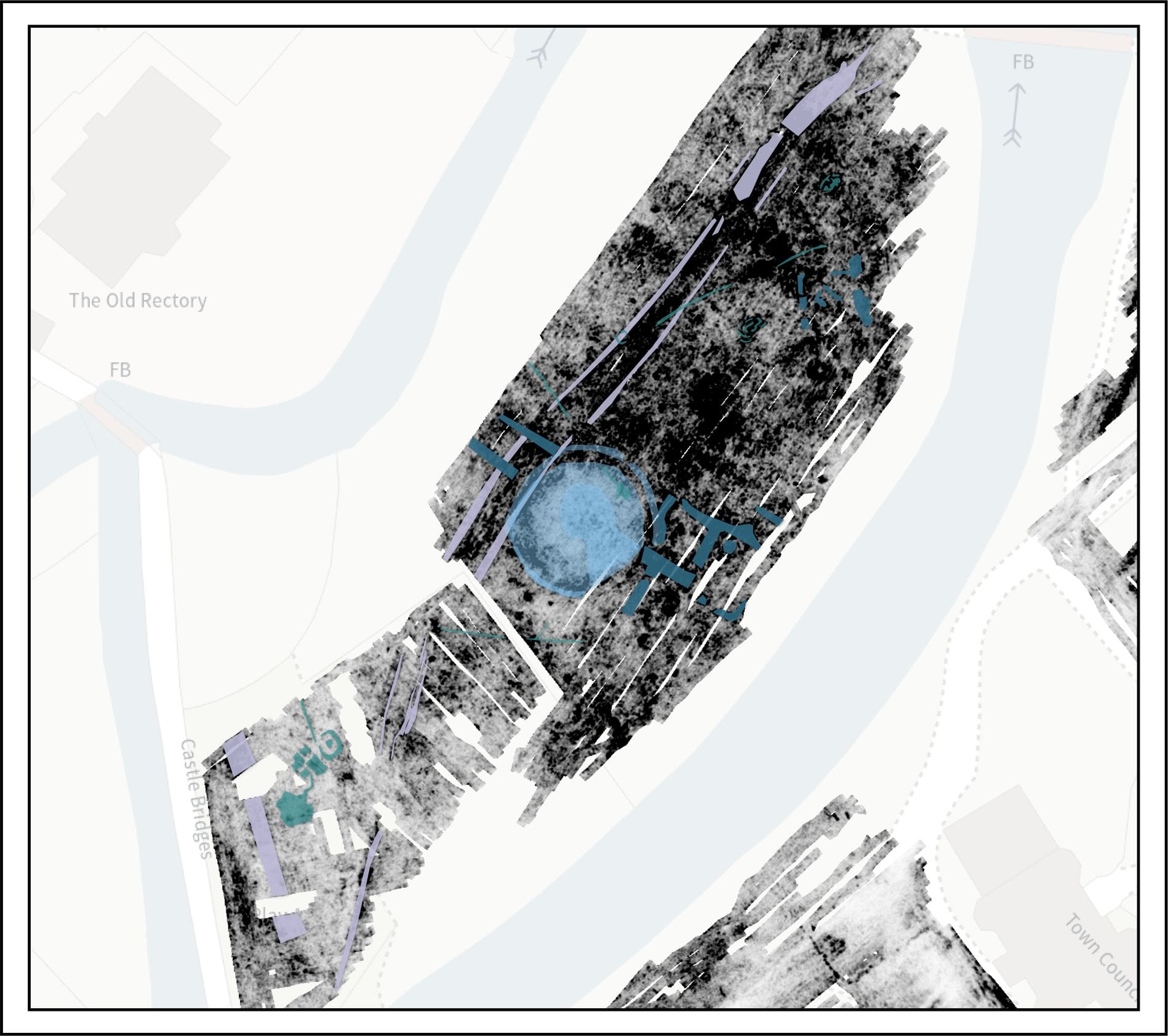
The Island Investigations
On "the Island" area, the survey identified a prominent sub-circular anomaly approximately 15 metres in diameter, interpreted as a probable well chamber covered by a mound. The feature exhibits characteristics consistent with a subterranean chamber from which water could be pumped, probably via a pipe identified on the eastern side of the structure. A trackway was also detected running along the spine of the Island at depths between 0.7 and 1.5 metres.
[Image: GPR depth slice showing the circular well feature and trackway on the Island]
Technical Innovation and Future Work
The survey employed cutting-edge technology, providing comprehensive three-dimensional coverage of the subsurface archaeology. The depth-slice analysis approach, creating horizontal maps at 15-centimetre intervals from the surface to 2.25 metres in depth, provided an unprecedented understanding of the site's archaeological stratigraphy. This methodology allowed features from different historical phases to be distinguished and mapped with remarkable precision.
These findings will directly inform the Hertford Castle Greenspace Renewal Project's development plans, ensuring that significant archaeological features are appropriately considered and protected. The survey has demonstrated that the castle grounds contain extensive, well-preserved archaeological remains spanning nearly a millennium of human activity, providing a comprehensive baseline for understanding the site's subsurface archaeology and guiding any necessary archaeological investigations associated with the renewal project.
Most importantly for the renewal project, the survey has identified specific areas where archaeological remains are most significant and best preserved, enabling informed decision-making on development proposals and appropriate mitigation measures where necessary. The results underscore that both the medieval royal palace complex and the post-medieval garden designs represent significant archaeological resources deserving of recognition and protection as part of our shared heritage.