
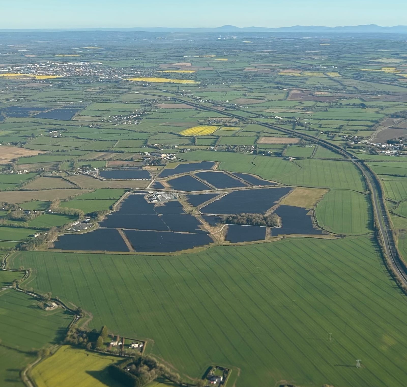
A new sector-wide guide, Archaeology and Solar Farms: Good Practice Guide, was published on 14 April 2026 by ALGAO, the Chartered Institute for Archaeologists, FAME, Historic England and Solar Energy UK, with support from Cadw and the Historic Environment Division, DfC. It sets out, for the first time, a consistent framework covering England, Wales and Northern Ireland for how archaeological risk on large-scale ground-mounted solar farms should be assessed and managed through the planning process.
For developers, consultants and planning authorities, the guide brings welcome clarity to a process that has, until now, varied considerably between local planning authorities and projects. Below, we set out the key implications and how TerraDat's survey capability aligns with the guide's recommendations.
What the guide changes
The guide does not introduce new statutory requirements, but it does establish a set of ten shared principles intended to standardise practice. The most significant points for developers are:
- Design flexibility should drive evaluation strategy. Because solar farms typically retain scope to reposition infrastructure, archaeologists are encouraged to use non-intrusive survey to identify sensitive areas early, so that micrositing can avoid them rather than relying on trial trenching alone.
- Zoning by ground disturbance. The guide distinguishes low-disturbance areas (panel arrays) from high-disturbance areas (substations, cable routes, compounds), and recommends that the evaluation effort be proportionate to the impact in each zone.
- A preference for post-determination trial trenching is supported, provided a sufficient suite of non-intrusive techniques has already been used pre-application to build confidence in the results, and the design retains flexibility to respond to whatever is found.
- Magnetometry as the default non-intrusive technique, given its speed, cost-effectiveness and suitability for the wide, dispersed footprint typical of solar schemes, supplemented by GPR or electromagnetic survey where additional depth or feature resolution is needed.
- A detailed pre-submission checklist (Section 7) that applicants are expected to complete for their archaeological advisor, covering the depth and spatial extent of every element of the scheme — arrays, cabling, access tracks, BESS, drainage, fencing and more.
Where TerraDat fits in
TerraDat's service offering maps closely onto the evaluation pathway the guide describes, and we already work to this model on live schemes:
Landscape characterisation informed by the desk-based assessment. We don't produce DBAs ourselves, but our reports draw directly on DBA findings — HER data, historic mapping and known heritage assets — to set the geophysical results in context and provide a detailed archaeological background, in line with the guide's expectation that non-intrusive results are interpreted alongside existing knowledge rather than in isolation.
Magnetic gradiometry at scale. Towed magnetometry is our core technique for solar farm evaluation, and our survey rates comfortably meet the guide's benchmark of around 20 hectares per day using ATV-towed systems. For larger schemes spanning several hundred hectares, this speed is essential for keeping evaluation timescales compatible with the wider project programme and the grid connection timeline.
Complementary techniques. GPR and electromagnetic surveys can be deployed alongside magnetometry where ground conditions, green waste, or specific archaeological questions warrant it. Given the difference in survey efficiencies compared with magnetometry, these are best used as targeted options over discrete areas rather than as standard, site-wide coverage — consistent with the guide's recommendation that additional techniques be used to build confidence in specific locations rather than as a blanket requirement.
UAV-based survey. The guide discusses drone-acquired LiDAR and photogrammetry for topographical modelling, but doesn't specifically address UAV-mounted magnetometry. Our MagDrone platform fills that gap: it's a useful option when ground access is restricted, crops or terrain rule out towed survey, or rapid landscape-scale coverage is needed to inform early feasibility or site-selection decisions — supporting the guide's broader emphasis on gathering information as early as possible in the project lifecycle. As with any non-standard technique, its use is subject to acceptance by the curatorial archaeologist and planning authority as a suitable methodology for the site in question.
Synthesis and reporting to support determination. The guide makes it explicit that evaluation results from multiple techniques should be fully synthesised at a landscape scale, rather than submitted as disparate specialist reports. Our reports are written with this in mind, presenting an integrated interpretation that gives planning archaeologists and developers a clear, defensible basis for design and mitigation decisions — including direct input to the Section 7 checklist where required.
Post-determination and conditioned works. Where trial trenching is secured by planning condition or DCO Requirement, our non-intrusive datasets provide the targeting information needed to keep that trenching proportionate and focused on genuine areas of uncertainty rather than blanket coverage — consistent with the guide's Principle 8. We don't undertake trenching ourselves, but our results are designed to inform the brief and project design for whoever does.
Timing matters
One point the guide stresses repeatedly is that geophysical survey should not be left until late in the project cycle. Access to agricultural land is often constrained by cropping cycles, and leaving survey too late reduces the ability to plan around them, delays the availability of data for design purposes, and increases the risk of costly delays post-determination. Early engagement with your geophysical contractor — ideally before or alongside the desk-based assessment — remains the single most effective way to keep a scheme on programme.
Just as important is full disclosure of site conditions at the point of quoting: standing crop, livestock, ground vegetation, waterlogging, access restrictions and any green waste or modern debris likely to affect magnetometer results. In our experience, unforeseen site conditions discovered on arrival are the single biggest source of time and cost overruns on geophysical surveys of this scale. The more accurately this is scoped up front, the more reliable the programme and quotation will be.
Get in touch
If you're bringing forward a solar farm application and want to align your evaluation strategy with this new guidance, we'd be glad to discuss survey design, timing and likely costs at an early stage. Call us on +44 (0) 2920 700127 or email web@terradat.co.uk.