
The advent of drone technology has revolutionised numerous industries and has significant potential for use in archaeology beyond just aerial photography. At TerraDat Geophysics, we understand the importance of efficient and precise surveying methods, particularly when preparing the ground for projects such as solar farms, wind farms, housing developments and linear infrastructure.
Areas with favourable ground conditions can be easily surveyed using our rapid acquisition systems, such as the Sensys Magneto gradiometer array. Where ground conditions become difficult, drone-mounted surveys may provide a solution. By mounting highly sensitive magnetometers on drones, we hope to develop rapid archaeological mapping for areas where access is difficult or dangerous.
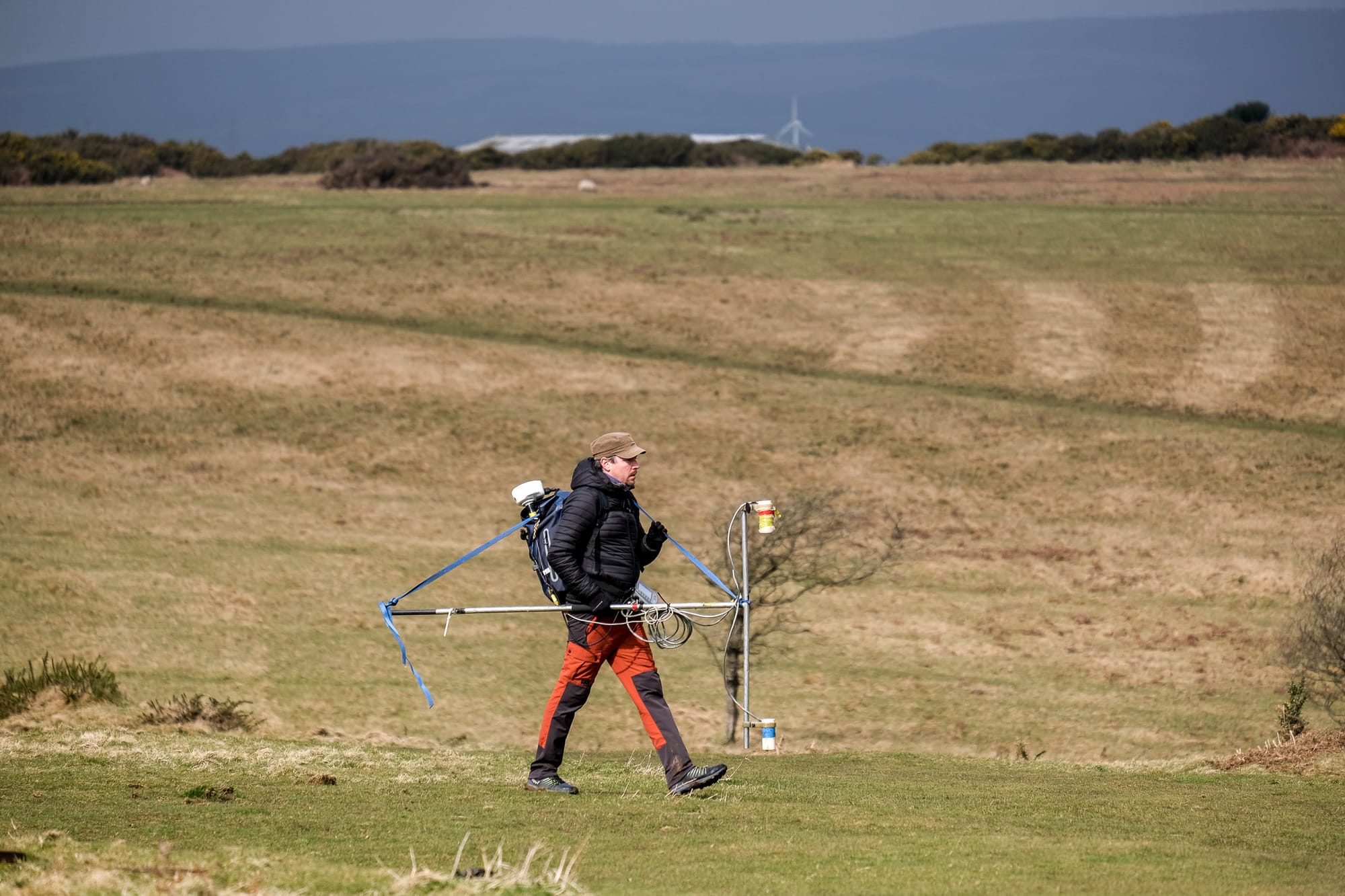
A commitment to research and development is at the core of our operations. We are dedicated to refining our methodologies and embracing innovative technologies to ensure the highest quality of geophysical surveys. The Geometrics G-858 caesium gradiometer is pictured above, a testament to our ongoing efforts to enhance accuracy. At our test site, we have rigorously compared the data collected by drone-mounted magnetometers with those from conventional walked surveys. This site is strategically embedded with known masses of ferrous targets, allowing us to calibrate our instruments and correlate the findings meticulously. This process validates the effectiveness of aerial systems and ensures that our clients benefit from the most reliable data, paving the way for informed decisions and successful project outcomes.
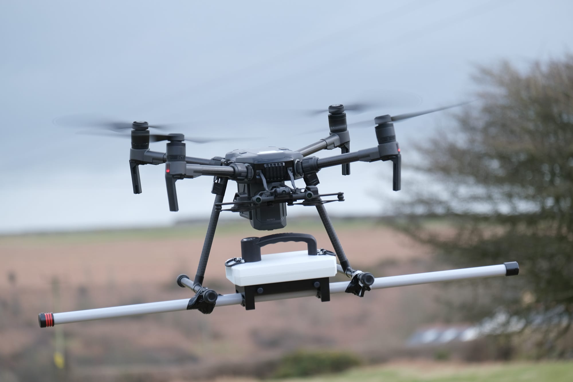
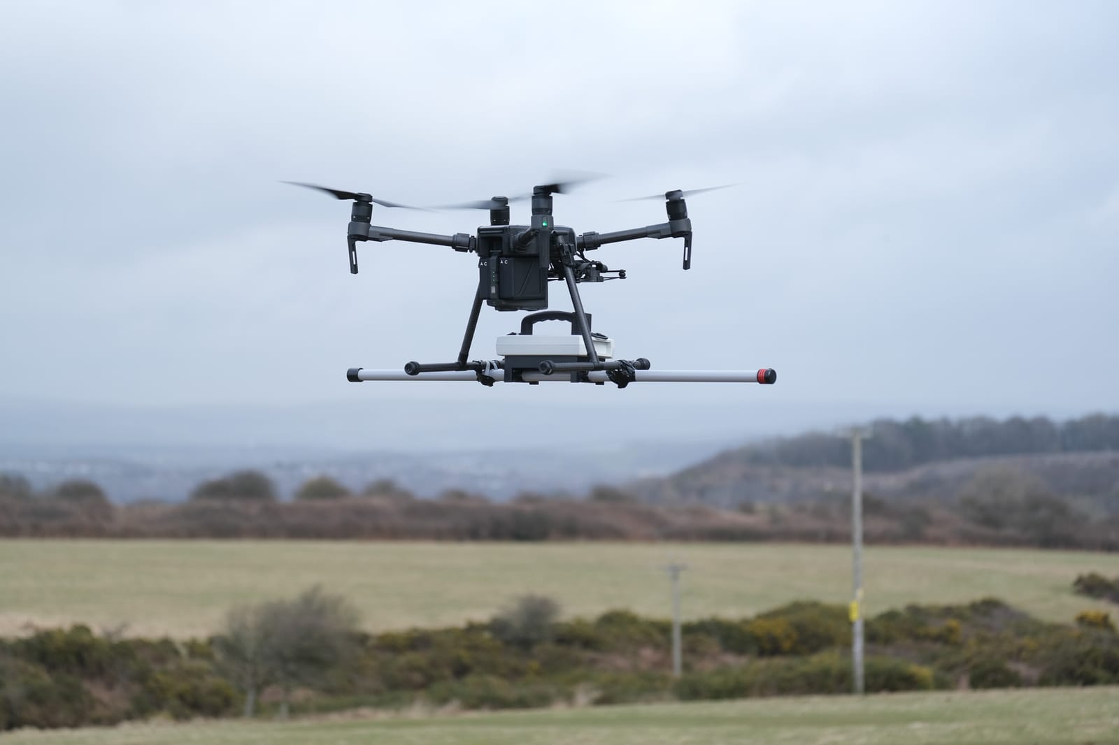
The Sensys Magdrone represents a significant leap forward in the field of aerial mapping, particularly regarding archaeological surveys. One of its standout features is the incorporation of radar altimetry, which allows the drone to maintain a constant flight height above the ground. This is crucial for the consistency and precision of the magnetic data collected. By flying at a steady altitude of 1-2 metres above the ground, the magnetometer's sensitivity is optimised, ensuring that the readings are accurate and free from the variability that comes with manual surveys. The Sensys Magdrone's ability to maintain a constant height results in high-resolution data that is essential for detecting subtle archaeological features, ultimately contributing to a more thorough and non-intrusive exploration of our historical landscapes.
Video of Magdrone magnetometer for low-altitude mapping.
The applications of aerial magnetometer surveys extend far beyond the realm of archaeology, offering versatile solutions across a range of industries. Our technology is particularly adept at uncovering unexploded ordnance (UXO), providing a vital service in areas where historical conflicts have left dangerous legacies. In the field of mineral exploration, these surveys accelerate the mapping process, identifying geological anomalies indicative of mineral deposits with speed and precision. Large-scale utility mapping also benefits from the aerial vantage point, as it enables the swift identification of buried pipelines and cables, which is essential for maintenance and planning.
The ability to deploy drones in hazardous or inaccessible areas ensures that critical data can be gathered without putting survey crews at risk. Whether it's navigating through challenging terrain or avoiding the complications of active sites, drone-mounted magnetometers like the Sensys Magdrone are changing the landscape of geophysical surveys, providing safer, faster, and more detailed data collection across a multitude of sectors.