
Archaeological Geophysics: Imaging the past with modern technology
Fans of Channel 4's "Time Team" will undoubtedly recognize the term "geofizz," a playful nod to the serious science of archaeological geophysics, a discipline that has brought countless subterranean secrets to light.
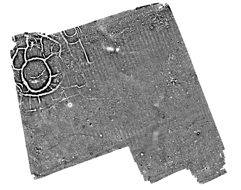
By measuring changes in the soil's physical properties caused by buried archaeological features, geophysics can uncover previously unknown archaeological sites and shed light on enigmatic remnants of our heritage. It gives us the remarkable ability to visualise what lies beneath the soil without any disruption, enabling the exploration of large areas with efficiency and care—a practice crucial in situations where traditional excavation is impractical, or the scope is too large.
Understanding Archaeological Geophysics
A geophysical survey comprises various sophisticated techniques that identify differences between the physical properties of buried archaeological features and the surrounding soil.
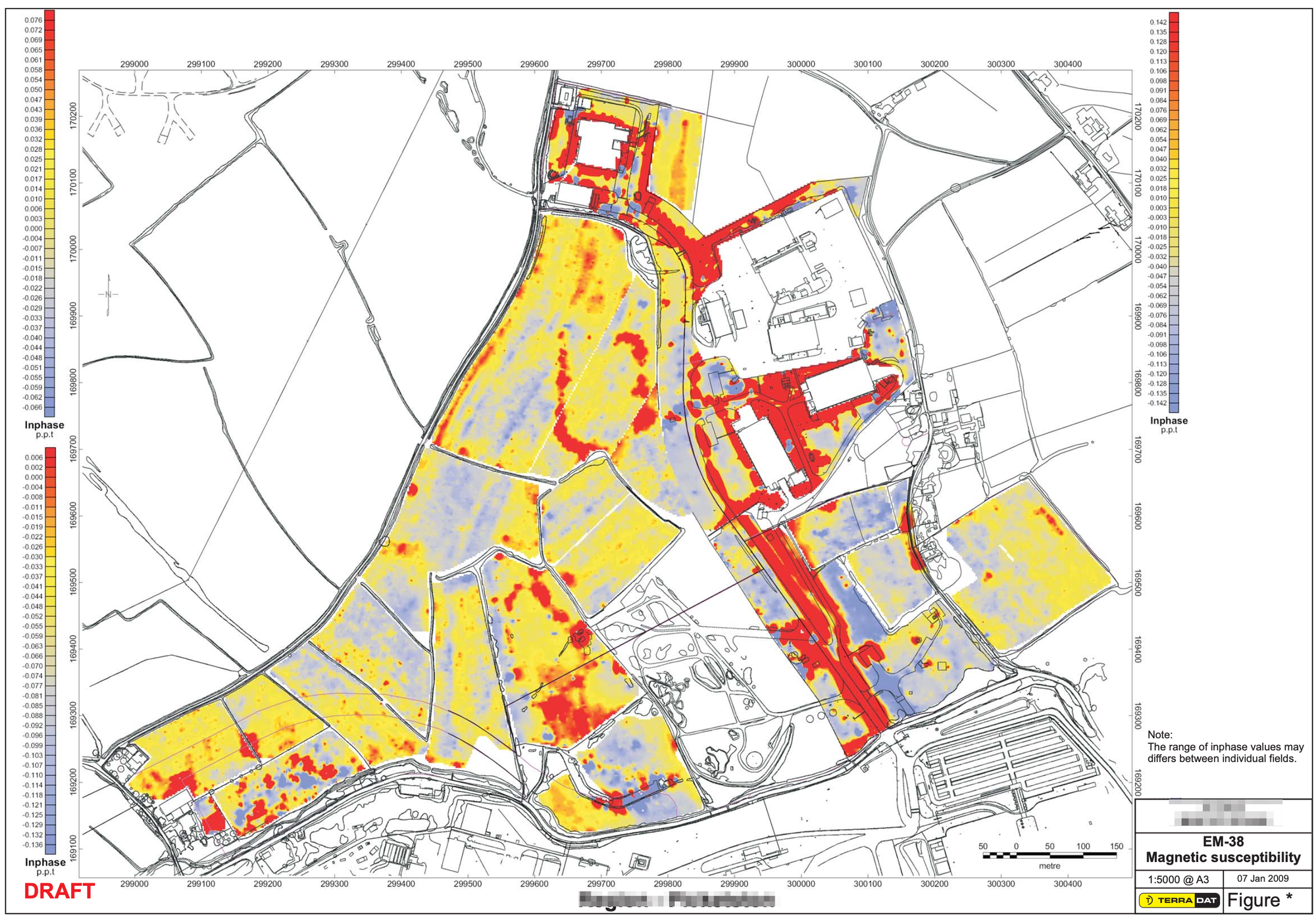
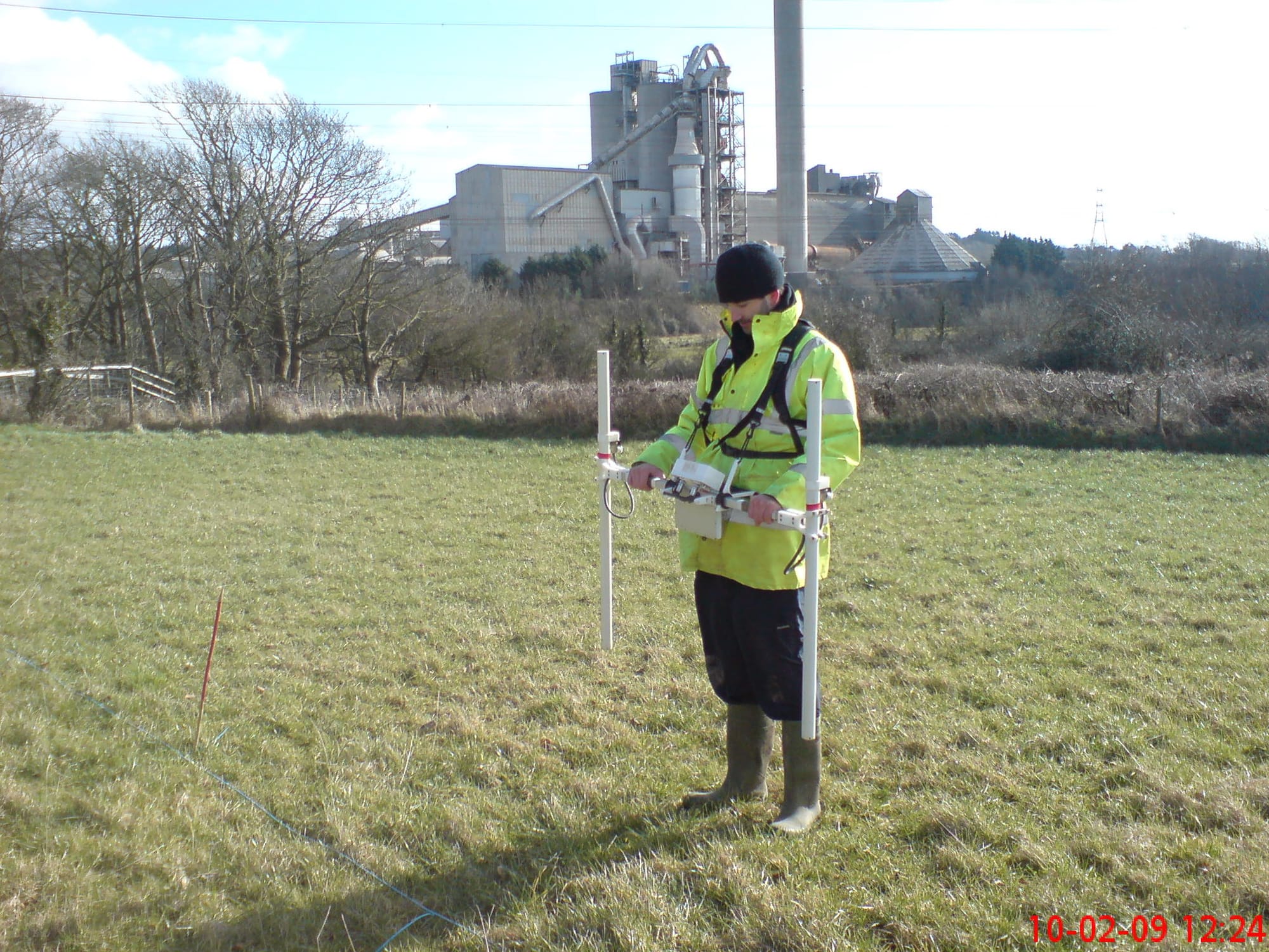
Our teams systematically gather data across archaeological sites using instruments that measure variations in the soil's physical properties caused by buried archaeology. The most commonly used instruments include magnetometers, electromagnetic induction (EMI) earth resistance meters, and ground penetrating radar (GPR).
Modern methods can cover extensive areas rapidly, potentially mapping out lost settlements and their regional setting. The possibility of regional-scale surveying afforded by modern instrumentation has revolutionised our comprehension of historical landscapes.
The scope of geophysical investigations is broad, enhancing our understanding of diverse sites, from stone circles and burial mounds to hillforts, Roman camps, villas, industrial remains, deserted villages, and historic gardens.
Choosing the Right Geophysical Techniques
The selection of geophysical techniques is tailored to each survey, considering the type of site, the nature and depth of expected archaeological features, the size of the area to be surveyed, and the time available. Local conditions such as vegetation, geology, soils, and terrain are alsoil's physical propertieso critical factors in this selection process.
These techniques, each with distinct advantages, often complement one another and are best used to maximize the richness of information gathered. TerraDat provides expert guidance on optimal survey specifications, ensuring the best approach for each unique site.
A geophysical survey is a component of the wider field of remote sensing, which is dedicated to acquiring information about the ground and what lies beneath without intrusive investigation. This field has expanded to include drone photography, photogrammetry, and aerial and satellite sensing.
At TerraDat, all these techniques come together with one goal: to reveal our buried past. By remotely capturing visual data and imagery, we can analyse and detect archaeological features, offering a window into history for scholars, developers, enthusiasts, and the broader community.
If you would like to find out more, please contact us on 02920 700127